A newspaper cutting showing the battle line on...
An account of the wounding, imprisonment and...
Pembrokeshire Archaeological Survey 1896-1907,...
'Historical Memoranda of Breconshire, A...
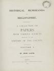
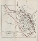
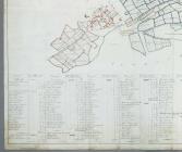
Map of Merthyr Tydfil, c. 1830
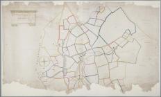
Map of the hamlet of Gellideg, c 1830
Maps of the Blaen-Sawdde estate in eastern...
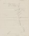
Sketch map by Sir Henry M. Stanley, 1902 [image...
Plan of the intended Brecon to Eardisley...
'The state and the condition of the...
A survey of the lands of Noyadd Trefawr,...
Estate map of Deuddwr, Montgomeryshire, 1748 ...
Bottom left quarter of a plan of the land...
Map of Estates the property of Owen Holland...
John Ogilby, 'Britannia: Volume 1 of an...
Survey of the Vaynol Estate, Caernarfonshire,...
Tooled leather map of northern France, showing...
Maps of the Glamorganshire and Aberdare Canals,...
Map of ironworks and collieries in...
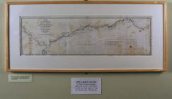
Plan of Canal from Brecknock to the...
Map of Redbrook Tinworks, Gloucestershire, 1840
Map of Monmouthshire divided into mineral and...
Gwynfor Evans, 'Save Cwm Tryweryn for...