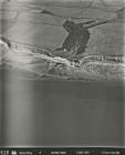
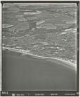
Aerial photograph 0175 Llantwit Major Beach,...
Aerial photograph 0174 Llantwit Major Beach,...
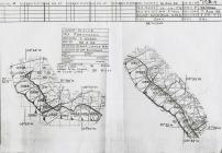
Flight Path Diagram of Aerial Photographs 7/8/1959
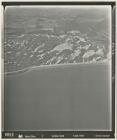
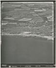
Aerial photograph 0137 Monknash Coastline
Aerial photograph 0136 Monknash Coastline
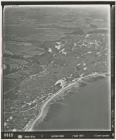
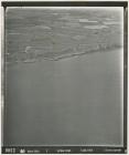
Aerial photograph 0412 Dunraven Bay and Monknash
Aerial photograph 0411 Dunraven Bay and Monknash
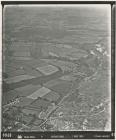
Aerial photograph 0421 Monknash Beach, Nash Brook
Aerial photograph 0420 Monknash Beach, Nash Brook
Aerial photograph 0419 Monknash Beach, Nash Brook
Aerial photograph 0418 Monknash Beach, Nash Brook
Merrytones 1950
Porthcawl, Aerial Photograph 0025
Aerial photograph 0054 of Merthyr Mawr. River...
Aerial photograph 0053 Merthyr Mawr Warren and...
Aerial photograph 0052 Merthyr Mawr Warren and...
Aerial photograph 0051 Merthyr Mawr Warren and...
Aerial photograph 0050 Merthyr Mawr Warren and...
Aerial photograph 0049 Merthyr Mawr Warren and...
Aerial photograph 0048 Merthyr Mawr Warren and...
Aerial photograph 0047 Merthyr Mawr Warren and...
Aerial photograph 0046 East Porthcawl, Newton,...
Aerial photograph 0045 East Porthcawl, Newton...
Aerial photograph 0044 Merthyr Mawr Dunes and...
Aerial photograph 0043 Merthyr Mawr Dunes and...
Aerial photograph 0042 Merthyr Mawr Dunes and...
Aerial photograph 0063 Ogmore by Sea and part...
Aerial photograph 0062 Ogmore by Sea and part...