Maps and diagrams, Skomer Island, 1940s-2000.


Description
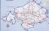
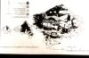
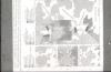
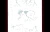
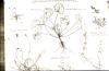
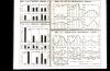
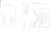
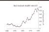
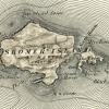
Various maps, diagrams, scientific illustrations, graphs and data sets relating to research on Skomer Island, including vegetation map, grazing diagrams, mixamitosis, burrow profiles, guano vegetation, fresh water histograms, water conditions, pland succession, grazing vegetation and greated black backed gull population figures.
More items with these tags
This item also appears in

Contact Us
To request take down or report racist, offensive or otherwise harmful content.

You must be logged in to leave a comment