Maps of Britain and Wales

Description
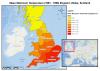
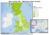
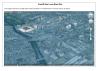
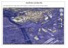
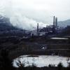
All Maps created to see the difference in the UK and Wales, including the damage of the Phurnacite, and the continuing environmental damage to our country. The map of the UK came from a website called diva gis. The data came from the Met Office. Maps were made using ESRI ArcMap. Credit to Tim Newth for helping create these.
External source:
Contact Us
To request take down or report racist, offensive or otherwise harmful content.

You must be logged in to leave a comment