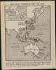
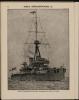
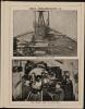
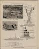
Atlas of the war maps, plans, diagrams and pictures illustraring the great European war


Description
1 atlas (88 p.) : maps, diags., ill. ; 24 cm.
External source:

More items with these tags
Contact Us
To request take down or report racist, offensive or otherwise harmful content.

You must be logged in to leave a comment