Port Talbot: Map/Figure
Content can be downloaded for non-commercial purposes, such as for personal use or in educational resources.
For commercial purposes please contact the copyright holder directly.
Read more about the Creative Archive Licence.
Description
South Wales. Maps. General. West
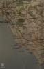
Map of coast. Port Talbot to Nash Point
External source:
Date Joined:
19/06/2017
Owner:
South East Wales Biodiversity Records Centre (SEWBReC)
Creator:
Dr Mary Gillham
License information:
Copyright Details:
Dr Mary Gillham 2017
Item uploaded:
27/11/2017
Views:
510
Favourites:
0
More items with these tags
Related items
-
SERGEANT PHILLIPS, GLAMORGAN CONSTABULARY
Type ItemUploaded by Ross Mather Police Memorabilia of Wales Collection -
Archie Thomas, WW2 Royal Navy Beach Commando from WW2 with Hugh Morgan (Age Cymru Dyfed).
Type ItemUploaded by The West Wales Veterans' Archive -
Archie Thomas. The Last Surviving RN Beach Commando of WW2. A Filmed Interview.
Type ItemUploaded by The West Wales Veterans' Archive -
WW2 Royal Navy Beach Commando Archie Thomas: The Last Survivor. Written Description
Type ItemUploaded by The West Wales Veterans' Archive -
The Independent Order of Rechabites (IOR) Tent No. 2591 in Briton Ferry
Type ItemUploaded by Graham T Emmanuel -
JUST AH LIKKLE PIECE OF JAMAICA IN PORT TALBOT
Type ItemUploaded by Neath Port Talbot Library and Museum Service -
Jersey Beach Hotel, Port Talbot
Type ItemUploaded by Llyfrgell Genedlaethol Cymru / The National Library of Wales -
High Street, Port Talbot II
Type ItemUploaded by Llyfrgell Genedlaethol Cymru / The National Library of Wales -
The Esplanade, Port Talbot
Type ItemUploaded by Llyfrgell Genedlaethol Cymru / The National Library of Wales -
The Institute, Port Talbot
Type ItemUploaded by Llyfrgell Genedlaethol Cymru / The National Library of Wales
Contact Us
To request take down or report racist, offensive or otherwise harmful content.
You must be logged in to leave a comment