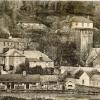
Crossing and Draining the marsh areas north and east of Penally Pembrokeshire
Content can be downloaded for non-commercial purposes, such as for personal use or in educational resources.
For commercial purposes please contact the copyright holder directly.
Read more about the Creative Archive Licence.
Description
A full account of the work done over time to drain the Ritec marsh and the crossing points together with maps.
Uploaded by
Date Joined:
29/03/2021
Item uploaded:
29/3/2021
Views:
155
Favourites:
0
More items with these tags
Related items
-
Map of Tenby Pembrokeshire
Type ItemUploaded by Penally History Group -
Map of Tenby Penally Pembrokeshire 1849
Type ItemUploaded by Penally History Group -
Maps of the Ritec Valley estuary Penally Pembrokeshire
Type ItemUploaded by Penally History Group -
Map of Tenby and Penally Pembrokeshire 1866
Type ItemUploaded by Penally History Group -
Map of the Tenby and Penally area 1969
Type ItemUploaded by Penally History Group -
Map of the Tenby and Penally area 1969
Type ItemUploaded by Penally History Group -
Maps of the Ritec Valley Penally Pembrokeshire
Type ItemUploaded by Penally History Group -
Drawing of Penally Pembrokeshire
Type ItemUploaded by Penally History Group -
Drawing of Penally Pembrokeshire 1800
Type ItemUploaded by Penally History Group -
Images of Holloway Water Penally Pembrokeshire
Type ItemUploaded by Penally History Group
Contact Us
To request take down or report racist, offensive or otherwise harmful content.
You must be logged in to leave a comment