"Kidwelly: A Journey Through Its Medieval, Industrial, and Religious Past"
Description
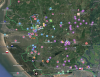
The Google MyMap of Kidwelly and its surrounding area provides a detailed exploration of the town’s historical evolution, weaving together its medieval, industrial, military, and religious past. At its core stands Kidwelly Castle, a Norman fortress that bore witness to centuries of Welsh-Norman conflicts and shifting power. The medieval streets and remnants of defensive walls hint at the town’s strategic importance. Beyond the castle, the map highlights the industrial legacy of the region, including the once-thriving tinplate works and coal mines that fueled economic growth in the 19th and early 20th centuries. Sites such as the nearby Mynydd y Garreg and Trimsaran coal mines, as well as the remnants of ironworks and brickworks, showcase the area’s deep-rooted connection to industry.
The military significance of the region is also represented, most notably by RAF Pembrey, an important World War II airbase. It played a crucial role in air defense, hosting squadrons that protected Britain’s western coast and training pilots for combat. The base later transitioned into a weapons testing facility, leaving behind a lasting legacy in the area’s wartime history.
Kidwelly’s religious heritage is equally prominent, with landmarks like St. Mary’s Church, medieval chapels, and monastic sites reflecting the town’s spiritual significance. The surrounding landscape, shaped by industry, war, and faith, tells a story of resilience and transformation, captured within the map’s detailed markers.

Related items


Contact Us
To request take down or report racist, offensive or otherwise harmful content.

You must be logged in to leave a comment