Place names: History through Wales' tithe maps (Welsh version)
Description
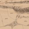
In the 1840's a series of maps was commissioned to assist in organising the payments of tithes. These tithe maps capture virtually the whole of Wales and together create a snapshot of our nation on the cusp of transformation. The aim of the Cynefin Project is to conserve, digitise and explore these maps to make the treasure trove of information they contain available to anyone, online, for free.The people and culture of Wales are deeply entwined with our landscape, but our relationship with the land and the way we use it have changed dramatically over the centuries. This film tells the story of our changing culture through the names we gave to places and we can travel back through time to understand the lives and concerns of people who lived centuries ago. *English version of the video available here: https://www.youtube.com/watch?v=84IalazkhOU

Related items


Contact Us
To request take down or report racist, offensive or otherwise harmful content.

You must be logged in to leave a comment